2003 02 15 Tuscarora, Ruby Mountains
2003 02 16 Steptoe Valley, Cherry Creek, Ruth
2003 02 18 Osceola, Ward, Wheeler Peak
2003 02 19 Ely to Truckee, Lane City
2003 02 20 Pyramid Lake, Smoke Creek Desert
2003 02 20 Pyramid Lake, Smoke Creek Desert
Today I made a day trip to Pyramid Lake and then up into the Smoke Creek Desert north of the lake. There was really only one reason for the trip, and that was to get some panoramic shots of water on the desert at sundown, suimilar to "normal" (non-panoramic) shots I already have that I like very much. It's about a 2 1/2 hour trip each way but is a great drive. You go east from here to Reno and then north into the high desert. Once you are 15 or 20 miles from Reno there is nothing out there. Not even a tree..
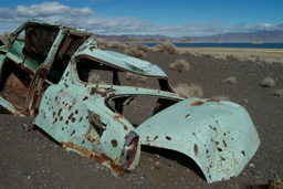
I had checked the maps for mines before leaving, and there are a few abandoned ones 5 miles south of the Lake. They are just fenced off scary mine shafts - no structures. I did find yet another shot up car though. What is it about shot up cars? If I did a "Shot Up Cars 2004" calendar would anyone buy it?
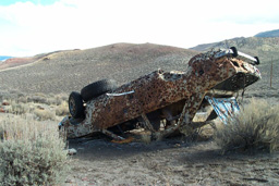 |
This one is really shot up..
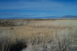
On to Pyramid Lake, which is really the only large body of water remaining from ancient Lake Lahontan, which covered much of western and central Nevada at one time. The lake has no outlet, and is fed only by rain and the Truckee river, which flows in from Lake Tahoe. It is about the same size as Lake Tahoe, but the lake level is slowly dropping. It's entirely within the Pyramid Lake Paiute Indian Reservation. It is a beautiful lake in it's own way. I don't think there is a tree within 10 miles of it, and maybe not even anything green except sage. It is named for a pyramid shaped formation at the southeast shore of the lake:
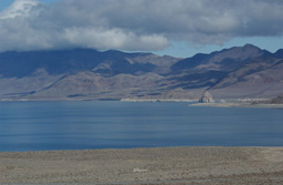 |
Here are a couple more shots of the lake:
 |
 |
At the far north end of the lake there is a long row of tufa extending out into the lake. You can see in the above photo that there is also a hot spring underwater in the tufa. Here's a good link: Pyramid Lake, Nevada: A Visitor's Guide to facilities and attractions from The Complete Nevada Traveler
And I ran across another one for the calendar on the drive along the lake:
 |
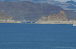
You can see the whole line of that tufa in the background. This formation is called "The Needles" and is closed to the public by the Pauite. I'd like to get permission to get closed and photograph them someday.
Here is one more shot taken along the shore of Pyramid Lake. The horizontal bands of rock are ancient shore lines..
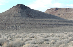 |
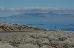
About 15 or 20 miles of gravel road gets you to a low pass from which you can see the Smoke Creek Desert in front of you:
 |
 |
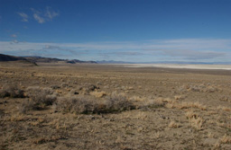 |
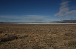
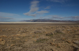
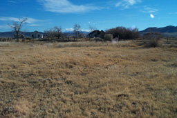
The mountains in the far distance are probably 40 or 45 miles away. About 5 miles into the desert you come across the abandoned Bonham Ranch, which I have photographed several times:
 |
 |
The above is the view looking into the desert from the ranch. The only reason this ranch is/was here is that there are springs. They are flowing and it is sort of odd to hear all this water out here. It's quite green in the summer.
So, getting into "the spot" further north in the desert, I now need:
 |
And this is why:
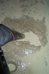 |
But I got a long sequence of panoramic shots out in the shallow water. Lots of still water and reflected light, both during and after sunset:
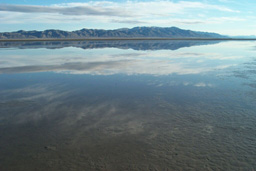 |
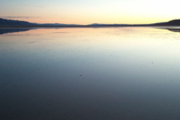 |
These above two are sort of representative of the panoramics. These were taken with the little point and shoot I have. I could not haul much gear out here since there isn't exactly anyplace to set anything down!
On the way back it was pitch dark and I stopped to look at the stars. There sure are a lot of them Saw 3 satellites and a meteor too.
Today (21st) I am going to go to Sand Mountain near Fallon. It's another day trip. I have been there a couple of times before but both times the conditions were not great. Also looks like the photo trip is going to run out just as I run out of film. Nice timing.